
Key takeaways
- The National Weather Service issued Severe Thunderstorm Watch 586 at 1:06 p.m. EDT on Sunday, August 16, 2026, for six Northeast Ohio counties: Holmes, Mahoning, Portage, Stark, Summit, and Trumbull. The watch was initially scheduled to remain in effect until 8 p.m.
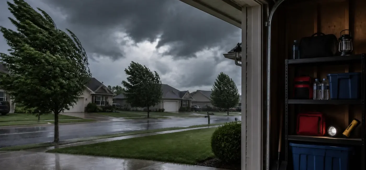
- A watch means conditions are favorable for severe storms. A warning means a dangerous storm has been detected or observed and you should take shelter immediately. Short-duration warnings mentioning 60 to 70 mph wind gusts were issued across parts of Ohio during the afternoon.
- The 1:43 p.m. NWS Cleveland Hazardous Weather Outlook highlighted the watch and possible localized flooding from heavy rain in the six-county area. Cuyahoga County, which includes the city of Cleveland, was not listed in Watch 586 at the time checked. A trending search for “Cleveland weather” does not mean every part of Greater Cleveland has the same alert level.
- If a warning reaches your location, move to a small interior room on the lowest floor of a sturdy building and stay away from windows. A vehicle, porch, garage doorway, or area under a tree is not a safe shelter. Never drive into a flooded road.
- County and expiration details in this article were checked at 2:10 p.m. EDT. Warnings can be issued, extended, replaced, or canceled within minutes. Confirm your current location through the NWS active-alert page, Wireless Emergency Alerts, or NOAA Weather Radio.
This guide cross-checks the live NWS alert feed, the NWS Cleveland Hazardous Weather Outlook, and official thunderstorm and flood-safety guidance. It is designed as an action plan rather than a rewrite of breaking-news reports. Weather changes quickly; always follow the newest NWS issuance time and instructions over any fixed time printed in an article.
What happened
NWS Cleveland issued Severe Thunderstorm Watch 586 at 1:06 p.m. EDT for Holmes, Mahoning, Portage, Stark, Summit, and Trumbull counties. The notice named communities including Akron, Alliance, Aurora, Austintown, Boardman, Canton, Kent, Killbuck, Massillon, Millersburg, Niles, Ravenna, Streetsboro, Warren, and Youngstown. The watch was posted through 8 p.m., although watches may be canceled early or extended as conditions evolve.
Other NWS offices issued portions of the same watch for East-Central and Southeast Ohio, Western Pennsylvania, and parts of West Virginia. Ohio counties in those notices included Belmont, Carroll, Columbiana, Coshocton, Guernsey, Harrison, Jefferson, Monroe, Muskingum, Noble, Tuscarawas, Athens, Gallia, Jackson, Lawrence, Meigs, Morgan, Perry, Vinton, and Washington. Anyone traveling between Akron or Canton and the Pittsburgh area, or south and east through Ohio, needed to check alerts for the entire route—not just the weather at the starting address.
More specific severe thunderstorm warnings followed the watch. At 2 p.m., NWS Cleveland identified a radar-indicated severe storm near Louisville in Stark County moving east at about 40 mph. That warning cited a hazard of 60 mph wind gusts and potential damage to trees and power lines. Other warnings in East-Central Ohio around the same period mentioned 60 to 70 mph wind gusts. Individual warnings can last only 15 to 45 minutes, yet another storm may trigger a new warning for the same community later.
The 1:43 p.m. NWS Cleveland Hazardous Weather Outlook said heavy rain with any thunderstorm could produce localized flooding in the six counties covered by the watch. The same outlook did not identify hazardous weather at that time for Cuyahoga, Lorain, Lake, Geauga, and several other northern counties. Cleveland’s point forecast still called for showers and possible thunderstorms with locally higher rainfall in storms. That distinction matters: a routine thunderstorm forecast, a severe thunderstorm watch, and a severe thunderstorm warning are three different levels of information.
Why “watch” and “warning” require different actions
A watch identifies a broad area and time window in which severe storms are possible. This is the time to adjust outdoor plans, charge phones, identify shelter, bring in objects that can blow away, and make sure every family member can receive alerts. It does not mean a severe storm is occurring in every town, but it does mean waiting until the sky looks dangerous may leave too little time.
A warning covers a smaller area where the threat is occurring or imminent. Radar may indicate damaging wind or hail, or trained observers may have reported hazardous conditions. Do not stand outside to confirm what the sky looks like, and do not try to drive home through the storm. Move immediately to the nearest sturdy building and an interior room away from windows. If you are just outside the warning polygon but close to the storm’s projected path, keep monitoring updates.
Who may be affected
Residents and visitors in the six Northeast Ohio watch counties face the most direct need to prepare. People working construction, delivery, landscaping, agriculture, or utilities—and anyone at a park, pool, sports field, festival, campsite, or lake—should act earlier because reaching shelter may take longer. The absence of rain at your exact location is not proof of safety. Gusty outflow winds can arrive before the heaviest rain.
Drivers may face several hazards at once: reduced visibility, fallen branches, dark traffic signals, standing water, and sudden road closures. Low crossings, roads beside creeks, underpasses, and poorly drained intersections can become dangerous during a short downpour. A navigation app may continue suggesting the fastest route even when water covers the road. Its arrival estimate does not certify water depth, current speed, or pavement condition.
People in mobile homes, RVs, tents, garages, sheds, or other light structures should identify a sturdier building before a warning. Straight-line thunderstorm winds can topple trees and seriously damage roofs, siding, and manufactured structures even when no tornado warning exists. Calculate how long it will take to reach shelter while the watch is active, not after damaging wind reaches the area.
Households that depend on powered medical equipment, refrigerated medicine, elevators, or electrically operated mobility equipment should make outage planning a priority. Check backup batteries, manufacturer instructions, the emergency plan provided by the medical team, and building-management contacts. A power loss involving life-sustaining equipment is not an ordinary inconvenience; follow the urgent procedures provided by the utility and health-care team.
Children, older adults, people with hearing or vision disabilities, and family members who may not understand an English-language alert need a clear communication plan. Do not rely on one person’s phone. Use at least two alert methods when possible, such as Wireless Emergency Alerts plus a weather app, local notification system, or NOAA Weather Radio. Agree on a short instruction everyone understands: prepare during a watch; move to the interior shelter immediately during a warning.
What to do now
1. Confirm your current county—not just the nearest city
“Near Cleveland” or “toward Akron” is too broad for a warning decision. Use your phone’s map to confirm the address and county, then check whether the location is inside the NWS warning polygon. If you are at work, school, a restaurant, or on the road, use that current location rather than your home address. A Cuyahoga County resident driving in Summit or Stark County needs the alert for the road they are on.
2. Use the watch period to secure objects and prepare for an outage
Bring in lightweight chairs, toys, planters, trash cans, and loose grill tools that could become airborne. Do this before thunder arrives. Do not climb onto a roof or ladder, or remain in the yard, once thunder is audible or a warning is active. Charge phones and battery packs, place flashlights where they are easy to reach, and avoid using candles as primary outage lighting because of the fire risk.
Keep refrigerator and freezer doors closed and take out any water or simple food you may need before the storm. Use manufacturer-approved surge protection for electronics. Never handle electrical plugs with wet hands. A portable generator must run outdoors, well away from windows, doors, and vents—not inside a house, basement, porch enclosure, or garage, even with the garage door open. Confirm that carbon-monoxide alarms are working.
3. During a warning, move to an interior room on the lowest floor
If the building has a basement that is not flooding, use an area away from windows. Without a basement, choose a small interior bathroom, hallway, or closet on the lowest floor. Stay away from glass doors, large windows, exterior walls, entryways, and garage doors. Sturdy shoes can reduce injury from broken glass and debris after the storm. Bring pets into the shelter area with a carrier or leash.
At a school, shopping center, house of worship, or office, follow the building emergency plan and staff directions. Do not remain in a glass lobby or a large open-span room. Gyms, auditoriums, and warehouses may have wide roof structures that are more vulnerable to strong wind. Move to the designated interior shelter. Elevators can stop during an outage; use stairs when the building’s emergency instructions direct you to do so.
4. If you are driving, find sturdy shelter before the warning reaches you
A vehicle offers limited protection from damaging wind and flying debris. During the watch, review your route and identify public buildings or other sturdy shelter options. If a warning is issued while you are driving, safely leave the road and enter the nearest substantial building when possible. Do not park beneath trees, power lines, or an overpass. If rain makes visibility extremely poor, slow gradually and stop only in a safe location away from flowing or rising water.
5. Never enter a road covered by water
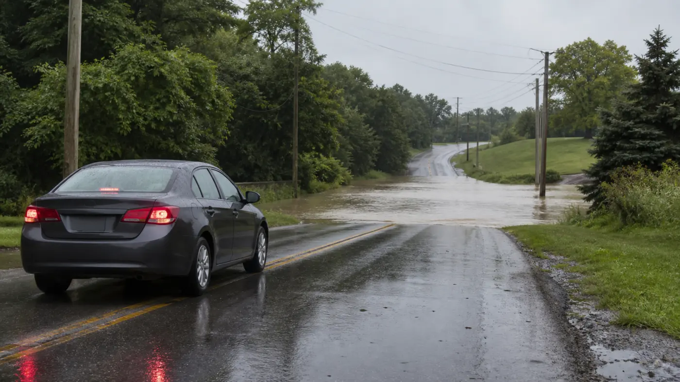
The NWS safety message is direct: “Turn Around, Don’t Drown.” Water that looks shallow may conceal washed-out pavement, a missing shoulder, or a strong current. Another vehicle’s successful crossing does not establish that your vehicle can make it. Never move or drive around a barricade. Turn around early and use a safe alternate route.
If rising water traps a vehicle, call 911 and give the most precise location possible. Whether it is safer to remain with or leave the vehicle depends on water speed, depth, and surrounding terrain; do not make a blanket decision based on a social-media tip. Do not walk into fast-moving water, and follow emergency responders’ instructions. Stay away from water touching electrical lines or equipment.
6. Treat downed lines and power outages as separate hazards
A fallen power line may still be energized. Stay far away from the line and from any tree, fence, vehicle, or standing water it touches. Report it to 911 and the electric utility. Never try to move it or push it with a vehicle. At an intersection with dark signals, follow Ohio law and police direction carefully, and do not assume every other driver will respond correctly.
During an outage, keep refrigerator doors closed, conserve phone power, and use the utility’s official outage map. Verify the source of any restoration estimate circulating on social media. Running a generator or charcoal grill indoors can quickly produce lethal carbon monoxide. Headache, dizziness, nausea, weakness, or confusion may be signs of exposure; move to fresh air and call 911.
7. Wait for official clearance and check for secondary hazards
Do not go outside immediately because the rain becomes lighter. Another storm cell, lightning, or rising water may follow. Confirm that the warning has expired without replacement and allow adequate time after the last thunder before resuming outdoor activity. When checking the property, look first for power lines, hanging limbs, a gas odor, structural damage, and water in the basement.
Photograph damage only from a safe location and record the time for an insurance claim. If you smell gas or see major wall or roof deformation, remain outside until the fire department or utility says entry is safe. Never step into basement water when electrical equipment may be energized. If an extended outage affects food or medicine, use FDA, CDC, pharmacist, or manufacturer guidance to decide what must be discarded.
How to verify official information
- NWS Active Alerts: Use the map or your location to find current watches, warnings, and advisories. Read the issuance and expiration times, hazards, movement, affected area, and instruction field.
- NWS Cleveland Hazardous Weather Outlook: Check county groupings, the day-one risk statement, and whether storm-spotter activation is expected. Verify the product timestamp at the top.
- Wireless Emergency Alerts: Confirm that government emergency alerts are enabled on your phone. Do not make the phone your only source; pair it with the NWS website or NOAA Weather Radio.
- Utility and transportation agencies: Use official outage maps and road-closure feeds for downed lines, dark signals, flooding, and restoration information. A general navigation app cannot determine that a flooded road is safe.
- 911 and local non-emergency services: Call 911 for a life threat, fire, downed electrical line, or rescue need. Use the local non-emergency number or 311 for non-urgent road debris and property reports when available.
On the NWS alert page, do not stop at the headline. Read the affected-area description or polygon, expiration time, hazard description, and instructions. A watch may cover many counties while a warning applies to a small corridor. Conversely, a county that was not in the original watch can receive a warning if a new severe storm develops. The newest live alert always matters more than an earlier county list.
Frequently asked questions
Was the city of Cleveland included in the severe thunderstorm watch?
As of the 2:10 p.m. check, the NWS Cleveland portion of Watch 586 covered Holmes, Mahoning, Portage, Stark, Summit, and Trumbull counties. Cuyahoga County, which includes Cleveland, was not on that list. Showers and thunderstorms were still forecast in Cleveland, and alert boundaries can change. Check the NWS using your current address.
Does a watch mean I must stay in the basement immediately?
A watch is primarily the signal to finish preparations and remain ready to shelter. Adjust outdoor plans, identify the interior room, gather household members, and charge devices. Move into shelter immediately if a warning covers your location or dangerous wind and lightning are approaching.
Can I remain in a garage if there is no tornado warning?
That is not a good shelter choice. Severe straight-line wind can damage a garage door and send debris through windows or exterior walls. Use a small interior room on the lowest floor. People in mobile homes and RVs should move to a sturdy building before the storm arrives.
What if the basement could flood?
Do not enter a basement that is already taking water or is in immediate flood danger. Use the lowest level that will remain dry and choose a windowless interior room. If local officials issue a flood evacuation order, their direction to move to higher ground takes priority. When wind and flood hazards overlap, location-specific official instructions are essential.
The water across the road looks shallow. Can I drive through slowly?
No. A driver cannot reliably see the depth, current, or condition of pavement beneath muddy water. Turn around and never cross a barricade. A short detour is safer than risking a stalled or swept vehicle and a dangerous rescue.
Is everything safe the moment a warning expires?
Not necessarily. A warning may be extended or replaced, and secondary hazards such as downed lines, damaged trees, and flooded roads can remain. Check the latest NWS alert and local road and utility information before traveling.
Can I run a generator in the garage with the door open?
No. Carbon monoxide can enter the home or accumulate in the garage even with the door raised. Operate a generator outdoors, well away from doors, windows, and vents, and follow the manufacturer’s instructions. If a carbon-monoxide alarm sounds, leave immediately and call 911.
What if my weather app disagrees with the NWS alert?
An app’s hourly forecast describes general probabilities; it does not replace an official warning polygon and protective instructions. Follow NWS alerts and local emergency authorities. Refresh any screen with an old issuance time, and use the app only as a secondary source.
Official sources
- National Weather Service API — Current Ohio Watches, Warnings and Advisories
- NWS Cleveland — Hazardous Weather Outlook
- National Weather Service — Thunderstorm, Lightning and Hail Safety
- National Weather Service — Flood Safety Tips and Resources
Fact-check completed at 2:10 p.m. EDT on August 16, 2026. Weather alerts can change immediately after publication. This article does not replace a live NWS alert; follow local emergency officials at the scene.