California El Niño Emergency: Flood and Storm Preparation Checklist
Smartor 편집팀
September 21, 2026

California has declared a statewide emergency to prepare for the 2026–27 El Niño winter. The declaration is not a statewide evacuation order and does not mean every community will flood. It is an early administrative step that lets the state move equipment, coordinate agencies, support local governments, and accelerate work before severe weather intensifies. For households, the useful response is not panic. It is checking address-specific risk, enrolling in local alerts, planning two evacuation routes, reviewing insurance, and preparing for outages before a storm is at the door.
California’s proclamation is designed to create preparation time before winter storms become an immediate threat. The state says agencies will be able to stage pumps, sandbags, flood-fighting supplies, traffic-control equipment, road-closure equipment, and snow-removal resources. Caltrans is directed to prepare equipment along vulnerable highways. The California National Guard can be positioned to assist with flood response, search and rescue, engineering, and logistics if needed. Natural-resources and environmental agencies are also directed to help local communities move flood, landslide, and debris-flow risk-reduction work forward.
The declaration also instructs the Governor’s Office of Emergency Services to coordinate planning and identify likely staffing and equipment needs. California says it will expand accessible, multilingual information about severe weather, flooding, alerts, evacuations, and power outages. These measures are about state readiness. They do not replace the warnings and evacuation instructions issued by a county, city, sheriff, fire department, or other local authority during a specific storm.
NOAA’s September assessment supplies the climate context. Ocean temperatures and atmospheric circulation across the tropical Pacific were consistent with a strengthening El Niño. The Climate Prediction Center estimated a greater than 90% chance of a very strong event during fall and winter 2026–27. For October through December, it estimated a 75% chance that the three-month RONI value would reach at least +2.5°C, exceeding the strength of earlier El Niño events in the record dating to 1950.
Those probabilities should not be treated as a forecast for a particular neighborhood. El Niño can shift seasonal storm patterns and make characteristic impacts more likely, but it cannot tell residents which street will flood or on what date. Local damage depends on each storm’s track and intensity, terrain, soil saturation, drainage capacity, tides and waves, and whether wildfire has stripped vegetation from an upslope watershed. A very strong El Niño raises the case for preparation; it does not guarantee record rainfall everywhere. Smartor’s separate 2026–27 U.S. El Niño winter outlook explains the broader regional picture beyond California.
People near rivers, low-lying areas, and the coast should start with address-level flood information and a route to higher ground. Heavy rain combined with large surf or high tides can slow drainage and affect coastal roads. Homes with below-grade garages, low entrances, or sump pumps should account for flooding and power loss occurring at the same time.
Residents below recent burn scars or near steep slopes need more than a standard flood-zone check. Fire removes vegetation that normally helps hold soil in place, and intense rain can trigger fast-moving debris flows. Monitor county emergency management, fire agencies, and National Weather Service products specific to the burn area. A plan that requires driving through a canyon or beneath a steep slope after rain has started may fail when it is needed most.
Mountain residents and drivers crossing passes may face snow, rockfall, mudslides, chain controls, and sudden closures during the same storm cycle. Check Caltrans QuickMap before departure and confirm that a navigation app’s suggested back-road detour is officially open. Never drive around a barricade; water, damaged pavement, or active response work may be hidden beyond it.
Older adults, people with disabilities, families with young children, and anyone using electricity-dependent medical equipment may need more time, transportation, and backup arrangements. Document medicine needs, refrigeration requirements, mobility assistance, equipment battery duration, and the people or services that can help. Contact health providers and equipment suppliers before an outage, not after the primary system is already unavailable.
Renters, homeowners, and small-business owners should separate wind or roof damage from flooding in their insurance review. Ready.gov notes that standard homeowners policies do not cover flooding and that a flood policy typically can take up to 30 days to become effective. Do not assume a policy purchased after a storm is imminent will provide immediate coverage. Ask a licensed insurer or agent to confirm building coverage, contents coverage, deductibles, exclusions, and effective dates in writing.
Enable Wireless Emergency Alerts on your phone, then use Listos California to find the signup page for the county where you live and the county where you work. Add text, voice, or email options that fit your household, and check language and accessibility settings. Choose a backup source such as NOAA Weather Radio, a local broadcaster, or the county emergency-management website so one dead phone does not cut off all information.
A Flood Watch means conditions are favorable and you should prepare and keep monitoring. A Flood Warning means flooding is imminent or occurring and requires prompt protective action. Local agencies may also distinguish between an evacuation warning and an evacuation order. Learn your county’s terminology now. When an order is issued, do not delay departure to collect more belongings.
Enter the addresses for your home, workplace, school, child-care facility, and frequent routes in FEMA’s Flood Map Service Center. The map is a starting point for long-term flood risk; it is not a real-time inundation forecast and may not capture a clogged neighborhood drain or a recent change in terrain. Add county flood-control maps, burn-scar debris-flow information, and coastal-flood products where relevant.
Walk around your property before the rain. Identify the lowest doorway, garage, storage area, electrical panel, water heater, HVAC equipment, and location of important documents. Notice where runoff travels and where it would collect if a drain were blocked. Renters should document drainage or leak problems with dated photos and notify the property owner or manager in writing while there is still time to respond.
Choose a primary route and an alternative that avoid rivers, underpasses, low bridges, the coast, and steep slopes when possible. Name one out-of-area contact and two meeting places—one near home and one outside the neighborhood. Confirm the reunification procedure used by schools, day-care centers, and care facilities. For pets, identify pet-friendly shelter or lodging options and keep carriers, food, medicines, and vaccination records ready.
Keep adequate fuel or electric-vehicle charge, but do not assume a car is always the safest place. Travel when authorities tell you to leave before roads flood. If water already covers a road, stop and turn around. A navigation app’s estimated travel time does not establish that a route is safe or legally open.
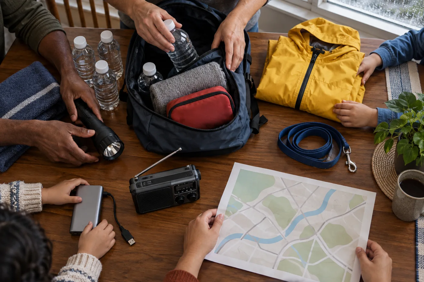
Stock water, shelf-stable food, prescription medicines, first-aid supplies, flashlights, batteries, power banks, a radio, cash, hygiene supplies, and weather-appropriate clothing for everyone in the household. Add infant supplies, glasses, hearing-aid batteries, mobility items, and pet food and medicine as needed. Separate a portable evacuation bag from the larger supply you would use while sheltering at home.
Store identification, insurance documents, lease or mortgage information, medicine lists, emergency contacts, and pet records in a waterproof container. Keep password-protected digital copies as well. Photograph the current condition of your home and major belongings for a possible claim. A paper contact list remains useful when a phone battery is dead or a cloud account cannot be reached.
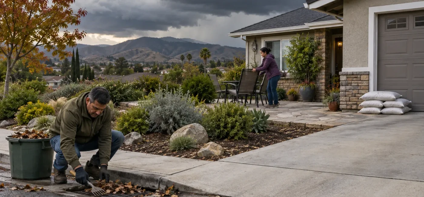
Remove leaves and debris from drains and gutters that can be reached safely from the ground. Do not climb onto a roof or ladder after rain or strong wind begins; use a qualified professional for unsafe work. Secure patio furniture, planters, decorations, and other items that could become windborne. Keep vehicles and trash containers away from storm drains.
Move valuables and hazardous materials above floor level. Test sump pumps and battery backups if your building uses them. Sandbags and backflow valves are not universal solutions, so follow local distribution and placement instructions and obtain qualified advice. Do not redirect water onto a neighboring property or block public drainage.
Know where your gas, water, and electric shutoffs are and who can operate them. Never stand in water to touch an electrical panel or approach a gas system when you smell gas. Shut off a utility only when it is safe and consistent with instructions from the utility or fire department. Smartor’s home utility shutoff guide explains the basic distinctions and safety limits.
Ask how the policy treats rain entering through storm damage, surface water entering the building, sewer backup, debris flow, damaged personal property, and temporary living expenses. Different causes may fall under different policies or endorsements. Record the date, representative, answers, and policy links, and verify the effective date of any new coverage.
Watch for contractors or door-to-door sellers using the emergency to demand large upfront payments. Verify licenses and insurance, obtain the work scope and cancellation terms in writing, and compare bids when time allows. A legitimate government alert or evacuation program will not require payment by gift card, wire transfer, cryptocurrency, or remote-access software.
Use current National Weather Service alerts and instructions from your county or city. A seasonal outlook or an old map circulating on social media cannot tell you whether a road is open now. If an evacuation is ordered, use the designated route promptly and do not return until authorities say the area is safe.
Turn around when water covers a road. Ready.gov and the National Weather Service warn that about six inches of fast-moving water can knock over an adult and about 12 inches can carry away many vehicles. The pavement may have washed out beneath apparently shallow water, and hidden debris or downed power lines can make the crossing even more dangerous. Never move or drive around a barricade.
If a vehicle is trapped in rapidly moving water, call 911 and follow emergency instructions rather than automatically stepping into the current. Ready.gov says to get onto the roof if water is rising inside the vehicle. If trapped in a building, move to the highest safe level. Do not enter a closed attic where rising water could eliminate your escape route; use the roof only when necessary and signal for help.
Operate a generator or other gasoline-powered equipment only outdoors, well away from windows, doors, and vents. An open garage door does not make indoor generator use safe. Do not touch wet electrical equipment or operate a breaker while standing in water. Stay far from downed lines and any water that may be energized, and report the hazard.
No. The proclamation speeds state preparation and resource coordination. Evacuate when the authority responsible for your location issues an order or emergency responders direct you to leave. Confirm that your county alert registration and phone settings work before a storm.
No. NOAA says a stronger event increases the chance of characteristic El Niño impacts, but local outcomes are not guaranteed. Storm tracks, terrain, drainage, soil conditions, tides, and burn scars all matter. The seasonal probability is a reason to prepare, not a street-level flood forecast.
Flooding can occur outside mapped high-risk zones. Consider FEMA data together with local drainage, past flooding, nearby slopes, burn scars, and coastal exposure, then discuss options with a licensed insurance professional. Do not assume a homeowners policy covers surface-water flooding, and verify any waiting period and effective date.
No. Sandbags can help redirect limited shallow water in some situations, but they cannot protect every structure or withstand every flood. Combine appropriate barriers with drain maintenance, moving valuables, electrical safety, insurance review, and an evacuation plan. Follow local placement guidance and do not block public drainage.
No vehicle makes an unknown flooded crossing safe. The roadway may be damaged beneath the water, and flow strength is difficult to judge. The National Weather Service says roughly 12 inches of rushing water can carry away many cars and about two feet can carry away SUVs and trucks. Turn around regardless of vehicle type.
Prioritize identification and insurance copies, prescription medicines, medical information, water, simple food, charging equipment, a flashlight, cash, clothing, and hygiene items. Add supplies for infants, older adults, disabilities, and pets. Keep the bag light enough for the person responsible for it to carry.
No. A generator must be operated outdoors, away from windows, doors, and vents. Carbon monoxide has no color or odor and can accumulate even when a garage door is open. Follow the manufacturer’s placement instructions, local fire-safety guidance, and test carbon-monoxide alarms.
For immediate safety, prioritize your county or city’s evacuation order, current National Weather Service warnings, and directions from responders at the scene. The monthly El Niño outlook explains seasonal risk but does not establish whether a road is open or whether a neighborhood must evacuate today. Check jurisdiction and timestamp before sharing.
브라우저 메뉴에서 앱 설치 또는 홈 화면에 추가를 선택해 주세요.