East Coast Coastal Flood Warnings: Roads, Tides, and Safety Checklist
Smartor 편집팀
September 24, 2026

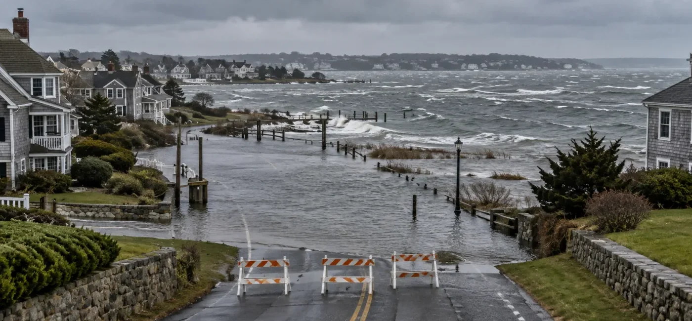
Coastal Flood Warnings are active for multiple parts of the U.S. East Coast. National Weather Service updates issued early September 24 include portions of North Carolina’s Outer Banks, Virginia’s Tidewater and Eastern Shore, communities around the Chesapeake Bay and tidal Potomac, the Delaware coast, and southern New Jersey. Conditions and expiration times differ by location, so do not treat the entire coast as if it has one forecast. Check the alert that applies to your county or ZIP code and note the high-tide cycles named in it.
NWS Mount Holly specifically warned of one to two feet of inundation above ground level in some low-lying areas near shorelines and tidal waterways in the Delaware Beaches and parts of southern New Jersey. Its alert describes widespread roadway flooding, roads becoming impassable, possible damage to vulnerable structures, dangerous surf, rip currents, beach erosion, and possible dune breaches. A flooded road that looks shallow is not a safe shortcut, and a beach or jetty is not a safe place to watch the storm.
Coastal flooding is not simply river flooding caused by heavy rain. Persistent onshore wind can push ocean water toward the coast, while high waves and astronomical tides prevent water from draining out of bays, estuaries, and tidal creeks. Water may rise again with the next high-tide cycle even after rain becomes lighter. Places well away from the open beach can flood when they are connected to tidal rivers or canals.
An NWS Mount Holly update issued at 5:36 a.m. EDT on September 24 said the Coastal Flood Warning for the Delaware Beaches and southern New Jersey zones including Atlantic Coastal Cape May, Coastal Atlantic, and Coastal Ocean could continue until 2 a.m. Saturday, September 26. The alert calls for one to two feet of inundation above ground level in low-lying areas near shorelines and tidal waterways. It also warns of widespread road flooding and possible damage to vulnerable structures. The same message mentions breaking waves as high as 12 feet for the Delaware Beaches and up to 9 feet in parts of southern New Jersey, along with a high risk of rip currents.
The NWS active-alert feed also listed warnings for Ocracoke and Hatteras islands, the Virginia Beach–Norfolk–Hampton area, the Virginia and Maryland Eastern Shore, parts of the Chesapeake Bay region, and tidal Potomac communities including Arlington and Alexandria. The timing, flood depth, and most dangerous tide cycle are not identical in those places. Open the alert for your location and read its area description, end time, event description, and official instructions instead of relying on a general headline.
A Coastal Flood Warning means moderate or major tidal flooding is occurring or imminent. Residents should take action to protect life and property and follow local emergency-management instructions. A Coastal Flood Advisory generally points to minor tidal flooding, but the most vulnerable roads can still flood and close. A Coastal Flood Watch means significant coastal flooding is possible, with some uncertainty about location or timing.
The label does not replace knowledge of your property. A below-grade garage or a road beside a tidal creek can suffer serious damage in an advisory area. A home on higher ground inside a warning zone may avoid direct flooding but still face outages, inaccessible roads, delayed emergency services, or school and business closures. Combine the alert level with local topography and evacuation guidance.
Risk is not limited to beachfront homes. Low-lying areas beside back bays, canals, tidal creeks, and estuaries may flood first. Streets that routinely collect water at high tide, repeatedly flooded intersections, and underground parking areas deserve special attention. If local officials ask residents to move vehicles, do it before water covers the route.
Floodwater hides lane markings, potholes, open manholes, damaged pavement, and debris. Even calm-looking tidal water can push a vehicle sideways, while salt water can damage brakes, wiring, batteries, and underbody components. Ready.gov says six inches of moving water can knock a person down and one foot can sweep a vehicle away. Never move a barricade or follow another driver into water.
Coastal flooding, high surf, and rip currents are separate hazards, but they may occur together. Waves can cross jetties and boardwalks while erosion undermines dunes and beach access points. If a beach is closed or a high rip-current risk is posted, stay out of the water regardless of swimming ability. Do not walk onto rocks or the end of a jetty to take photos.
An elevator outage, flooded wheelchair route, or loss of power for oxygen equipment and refrigerated medication can become urgent. Confirm transportation help, medical contacts, utility priority programs, and shelters that accept pets. Leave early when officials order evacuation; waiting until roads flood can remove safe options.
A dry storefront can still lose employee access, deliveries, refrigeration, internet service, and reservations. Decide whether staff can travel safely before deciding whether to open. Give customers verified road and utility updates instead of promising a reopening time that officials have not confirmed.
Move electronics, cleaners, paint, important records, and valuables from low floors to higher shelves. Test a backflow valve or sump pump before flooding, but never touch a plug or breaker while standing in water. If you do not know how to shut off gas, water, or electricity, follow instructions from the utility or a licensed professional rather than learning during an emergency. Smartor’s home utility shutoff guide explains the basic safety limits.
Fuel or charge the vehicle, close every window and the sunroof, set the parking brake, and keep insurance information and emergency supplies inside. Do not walk into rising water to rescue a car. If an EV charger, garage outlet, or electrical panel has been exposed to water, do not handle it; have the fire department, utility, or a licensed electrician assess the hazard. Starting a flooded car can cause additional damage, so contact the insurer and towing company first.
Slow down and stop where you can turn safely. Turn around at the barricade or water’s edge and use another route. If navigation keeps directing you to the same closure, add a safe waypoint or consult the state and local transportation map. Do not stop on a shoulder where you could block emergency and evacuation traffic; move to a legal parking area on higher ground.
If your vehicle becomes trapped in fast-moving water, Ready.gov advises staying inside, then moving to the roof if water rises inside the vehicle. Conditions can change within seconds, so call 911 and follow rescuers’ directions. Do not attempt to walk across the current or send a child or pet into the water. Do not open the hood to diagnose a stalled vehicle in floodwater.
A receding tide does not make the road safe. Washed-out pavement, open utility covers, salt water, sand, debris, and failed traffic signals may remain. Wait for local transportation officials to reopen the route. After reopening, limit nighttime travel and unnecessary trips until crews complete an inspection.
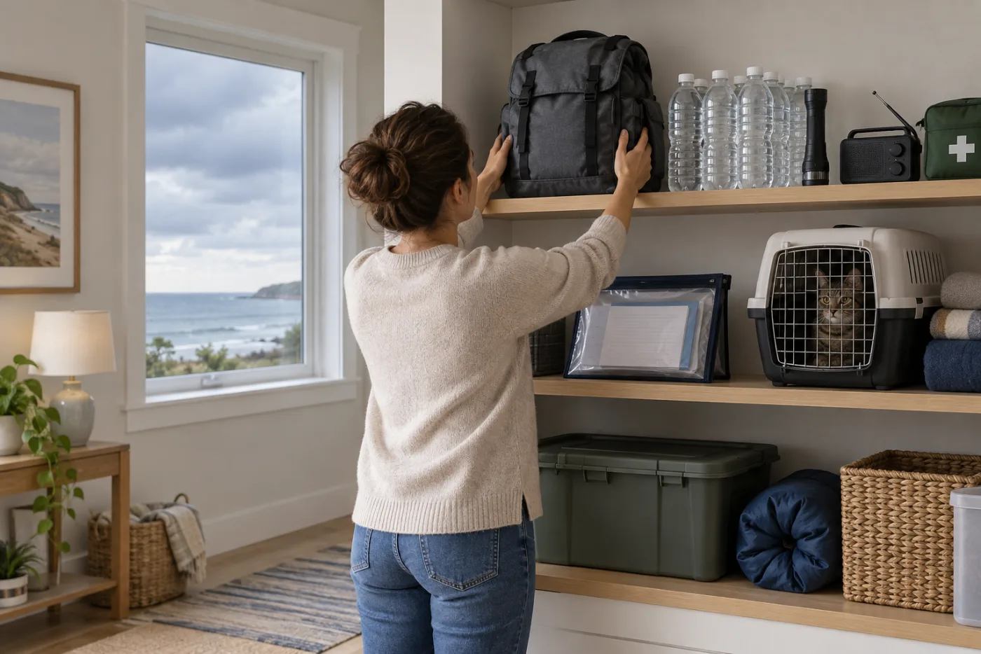
Gather flashlights, a battery radio, drinking water, ready-to-eat food, prescription medicine, and hygiene supplies. Run a generator only outdoors and well away from windows, doors, and vents. An open garage door does not make generator use inside a garage safe. Test carbon-monoxide alarms and replace weak batteries.
Before entering a flooded room, consider electrical hazards, structural damage, contamination, and mold. Never stand in water to operate a breaker or touch wet electrical equipment. Leave immediately and call 911 or the utility if you smell gas, hear hissing, or see sparks. Children, people with asthma, and people with weakened immune systems should not participate in cleanup where mold or contaminated water is present.
Search your location on the NWS alert page and read the area description, severity, end time, description, and instructions—not just the headline. A screenshot shared in a group chat may be outdated, so reopen the original page and check its issued and updated times.
The alert identifies the issuing office. Mount Holly, Wakefield, Baltimore/Washington, and Newport/Morehead City cover different zones and tide cycles. Check the office’s latest Coastal Flood Message and local observations.
At water.noaa.gov, choose a nearby gauge and distinguish the time zone, observed level, forecast level, and flood thresholds. One gauge does not represent an entire coastline, so select the station that best matches your bay, river, or shoreline.
Local agencies provide the most specific evacuation zones, road closures, vehicle-relocation instructions, shelters, and service changes. Prefer .gov pages, official alert subscriptions, and roadway signs over search ads and unofficial social accounts.
On-site closures and flag systems take priority over a general surf app. Stay out of the water during a high rip-current risk or when lifeguards close the beach. Conditions can change over a short stretch of shoreline.
Confirm that officials permit reentry. Stay outside if you see wall cracks, foundation movement, a sagging ceiling, or signs of a gas leak. Photograph damage from a safe location, contact the insurer, and then begin cleanup. Follow local health and disposal rules for porous materials touched by contaminated water.
Discard food that contacted floodwater even if the package appears intact. Check for local boil-water notices affecting wells or public water systems. If generator use continues, maintain carbon-monoxide protection and safe fuel storage. Do not reuse damaged extension cords or power strips after service returns.
Tell the insurer and repair shop if a vehicle contacted salt water. Corrosion can affect wiring and braking components later. Take photos before towing when it is safe to do so, but never block traffic or enter water to create a record.
No. The warning does not create one identical evacuation order for every address. Follow any local evacuation order immediately, especially if the only access road crosses a tidal flood zone. Households that need medical or mobility assistance should move before traffic and water remove safe options.
Yes. Wind, waves, high tide, and drainage from bays and estuaries drive coastal flooding. A later high tide may cause another rise after rainfall weakens. Keep checking the local NWS message and nearby tide gauge.
In the NWS Mount Holly alert, it means water could reach one to two feet above normally dry ground in low-lying areas. It does not mean every property will have the same depth. Road elevation, drainage, barriers, and wave action change the local outcome.
No. You cannot see its depth, flow, an open manhole, or missing pavement. Turn around and never bypass a barricade. Ready.gov warns that one foot of moving water can sweep away a vehicle.
If the garage has a flood history or local officials ask residents to relocate vehicles, move it early to a legal space on higher ground. Do not go downstairs to retrieve a vehicle after water enters.
High surf, rip currents, erosion, and debris can make the beach, dunes, boardwalk, and jetty dangerous even if you stay out of the water. Obey closures, beach flags, lifeguards, and police.
Not automatically. Closures, failed signals, sand, debris, and road damage may remain. Wait for the transportation agency or local government to reopen the route.
Flood policies often have waiting periods and may not cover an event already underway. Confirm terms with the insurer. During the emergency, focus on life safety and property protection, and use only verified insurance contact information afterward.
Use NWS active alerts, local emergency notifications, NOAA Weather Radio, and county or city emergency management together. Do not rely on a social-media screenshot; check the original alert’s issued, updated, and expiration times.
This article provides general disaster and transportation safety information. In an emergency, call 911 and follow evacuation orders and on-scene police, fire, and emergency-management instructions. Alerts and water levels change, so recheck official sources before traveling.
브라우저 메뉴에서 앱 설치 또는 홈 화면에 추가를 선택해 주세요.