
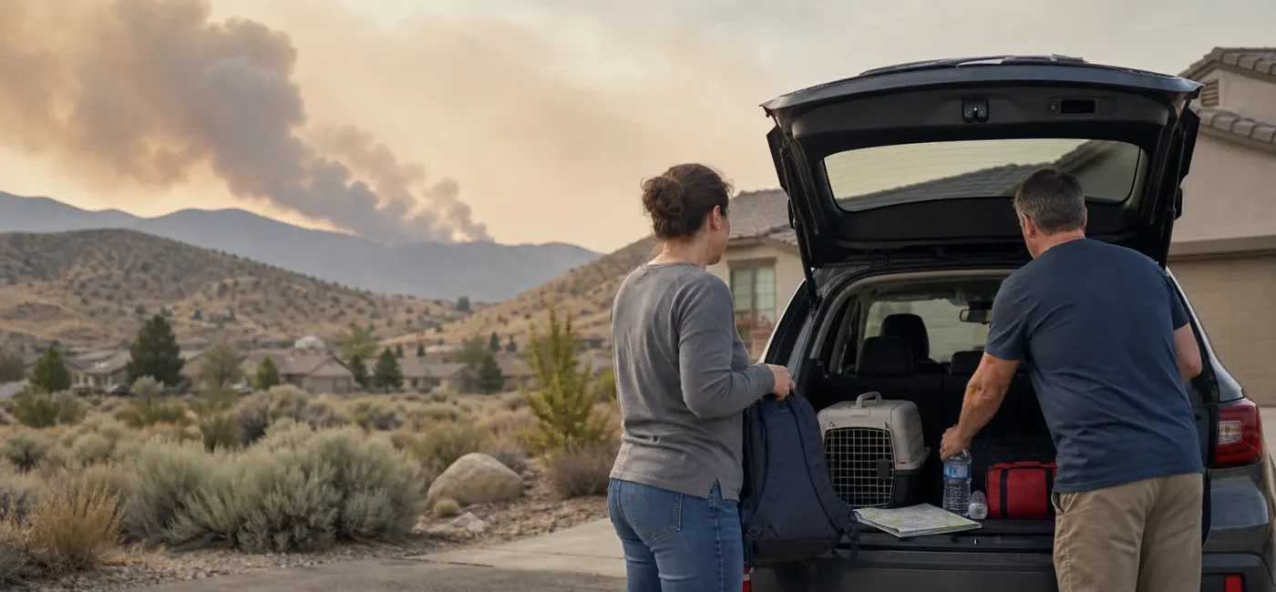
The Hawk Fire northwest of Reno grew rapidly into a major wildfire threatening neighborhoods and transportation corridors. In its August 23 daily update, Emergency Washoe said the fire started August 22 near Hawk Meadow Trail, had burned 10,522 acres and was 0% contained at the time of that release. Nevada’s governor declared a state of emergency in Washoe County as the fire spread and evacuation orders expanded. Major reporting updated August 24 said the fire had grown beyond 15,000 acres.
Conditions can change faster than an article can be updated. Evacuation zones, road closures and shelter locations may shift as winds and fire behavior change. Check your address on the official Washoe County Perimeter Map before relying on a screenshot or social-media post. If your location is under a GO-NOW order, leave immediately rather than waiting to see smoke or flames. This guide explains how Reno-area residents—and people checking on family in the region—can verify official information and act safely.
Key takeaways
- Check your exact address: Search the Washoe County Perimeter Map to see whether your location is in a GO-NOW, SET or GET READY zone. A live map is more useful than an old screenshot.
- GO-NOW means leave: Do not wait until fire is visible. Take people, pets, essential medication, identification, phones and chargers, then use the route directed by authorities.
- Keep 911 available for emergencies: Washoe County directed residents not to call 911 for general evacuation information. Use Emergency Washoe, the official map or 3-1-1 for zone questions.
- Recheck roads immediately before leaving: Closures involving US 395 and local roads can change. Compare Nevada 511 with the official evacuation map rather than relying only on a navigation app.
- Smoke is a separate hazard: People well outside the evacuation area may still face unhealthy fine-particle pollution. Check AirNow, reduce indoor smoke and wear a well-fitting N95 when outdoor exposure cannot be avoided.
- Return only after official clearance: An open road or clearer sky is not permission to reenter. Downed lines, gas leaks, unstable trees, hot ash and rekindling can remain after flames move away.
What happened
According to Emergency Washoe’s August 23 daily update, the Hawk Fire began off Hawk Meadow Trail, about one mile north of Cold Creek Trail in the Somersett area northwest of Reno. The update described grass and brush as the fuels and listed the cause as human. Approximately 400 personnel and resources from local, state and federal agencies—including 10 aviation resources—were working under unified command at that point. The precise cause and responsibility should not be assumed before investigators finish their work.
The official update listed 10,522 acres and 0% containment, with updated aerial confirmation pending. By August 24, major outlets reported that the fire had exceeded 15,000 acres. Wildfire acreage can differ because perimeter maps are produced at different times and may incorporate overnight infrared flights, aircraft mapping, satellite observations or refined ground reports. A changing acreage number does not automatically mean one source is wrong. For personal safety, the newest evacuation-zone map and on-scene direction matter more than the headline acreage.
Nevada’s emergency declaration directs state agencies to coordinate through the Nevada Emergency Operations Center and support the local response. The declaration itself is not an evacuation order for every address in Washoe County. Local authorities determine which zones must leave. Conversely, anyone whose address is placed in a GO-NOW zone should not wait for an additional statewide announcement.
Emergency Washoe said in the August 23 update that approximately 90,000 residents were within the combined GET-SET and GO-NOW zones at that time. The same release listed numerous road closures, an evacuation center and separate sites for small and large animals. Those details are a snapshot, not a fixed travel plan. Use the current Emergency Washoe update and Perimeter Map rather than an older list copied into a post or group chat.
Who may be affected
Northwest Reno and northern Washoe County residents
People in and around Somersett, Verdi, Peavine, Cold Springs, Lemmon Valley, Golden Valley and Stead should verify their address rather than relying on a neighborhood name. Zone boundaries can divide nearby streets. The absence of your subdivision’s name from a television headline does not establish that it is safe.
Older adults, disabled residents and people using medical equipment
Anyone who relies on oxygen equipment, dialysis, refrigerated medication, a powered wheelchair or transportation assistance should complete arrangements before a GO-NOW order. Identify an accessible destination, a driver and backup power for medically necessary devices. Do not reduce medication or put temperature-sensitive medicine directly against ice unless a pharmacist or clinician says that storage method is safe.
Families with children in schools or child care
Use the school district’s official notification channel for closures, early dismissal and reunification instructions. A route to a school may be closed even if the building is outside a fire zone. Follow the facility’s emergency release procedure instead of driving into a restricted area. Choose one out-of-area contact and two meeting places so family members know what to do if local calls do not connect.
Pet and large-animal owners
The official incident update separated the human evacuation center from small-animal sheltering and listed another facility for large animals. Locations and capacity can change, so verify the destination immediately before leaving. Pack carriers or leashes, food, water, waste supplies, medication, vaccination records and a recent photo. Moving horses and livestock takes far more time once smoke thickens or roads close; owners should act during the SET stage when advised.
People outside the fire zone who are exposed to smoke
Wildfire smoke can travel many miles. Children, pregnant people, older adults, outdoor workers and people with asthma, COPD or heart disease face higher risks when air quality deteriorates. Smoke odor alone is not a reliable measurement. Check AirNow and local public-health guidance. Smartor’s wildfire smoke indoor-air checklist provides a more detailed clean-room and filtration plan.
What to do now
1. Search your address on the official evacuation map
Open Emergency Washoe and follow its link to the Washoe County Perimeter Map. Enter your address, read the legend and note the map’s update time. Zoom in if your street is close to a boundary. Text your zone and destination to family while you have service, but treat a screenshot only as a reference. Refresh the live map because zones may expand or change.
Exact labels vary among jurisdictions, but the actions are straightforward. During GET READY, finish packing, fuel the vehicle, load animal supplies and identify routes. During SET, people who need extra transportation time and owners of large animals should consider leaving early as directed. During GO-NOW, stop gathering belongings and leave. Instructions from police officers or firefighters at the scene take priority over a map displayed on your phone.
2. Build a bag you can carry out in 10 minutes
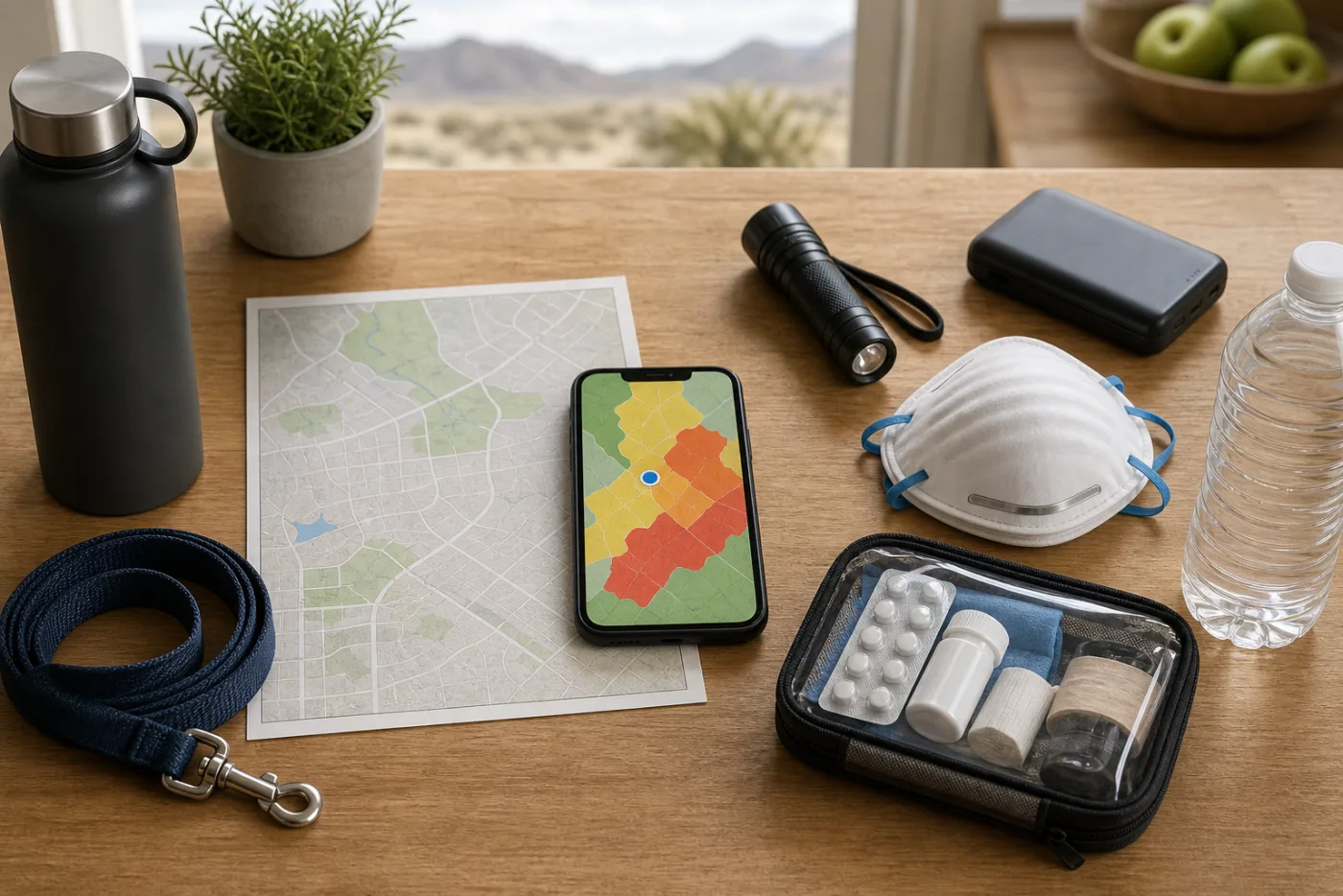
Include identification, insurance information, prescription medication, phone chargers, a battery pack, N95 respirators, water, shelf-stable food, a flashlight, cash, glasses, basic hygiene supplies and a change of clothes for each person. Do not lose evacuation time searching for original deeds or birth certificates. Use a prepared waterproof folder or encrypted digital copies. Keep refrigerated medication in an appropriate insulated container and carry a medication list with doses and prescriber contact information.
If you are still in a preparation stage and it is safe, record a quick video of each room and upload it to secure cloud storage. Never remain after a GO-NOW order to finish an insurance inventory. Smartor’s home inventory and disaster-claim checklist explains how to prepare that record before an emergency.
3. Prepare the vehicle and two routes
Back the vehicle into position facing the road, close its windows and keep the keys with you. Refuel during GET READY or SET if it is safe and the tank is low; do not delay a GO-NOW departure by waiting at a gas station. Identify two possible routes based on official closures. Do not use an unpaved mountain road, a narrow fire-access road or a gated route as an improvised shortcut.
Check Nevada 511 for state-road closures and the Perimeter Map for local restrictions. Navigation apps can lag behind a closure or direct traffic toward a blocked road. Never move around a barricade. Follow law-enforcement traffic control at intersections. In smoke, turn on headlights, reduce speed and leave extra distance between vehicles. Avoid stopping on a shoulder to photograph fire activity.
4. Reduce the family communication plan to one sentence
Everyone should know where to meet and who to contact if local communication fails. An out-of-area relative or friend can serve as a common check-in person when local networks are congested. Text messages may connect when calls do not. Send your location and destination, then limit nonessential video uploads and long calls.
5. Reduce smoke exposure
If officials say your area may remain in place, close doors and windows and set HVAC equipment to recirculate when possible. Use a portable air cleaner sized for the room where people spend the most time, and check the filter. Avoid indoor activities that generate particles, including smoking, candles, frying, prolonged gas-stove use and vacuuming. With window or portable air conditioners, check whether the unit draws outdoor air and seal gaps around the installation.
When outdoor exposure is unavoidable and the AQI is unhealthy, a well-fitting N95 or KN95 can reduce inhalation of fine particles. Cloth and surgical masks provide limited protection from wildfire smoke. Seek urgent medical help for severe trouble breathing, chest pain, confusion or blue lips. A cleaner indoor room is not a substitute for evacuation when your zone is ordered to leave.
6. Do only the safe, quick steps before leaving
If time remains and officials have not ordered immediate departure, close windows, exterior doors and the garage door. Move combustible patio cushions, doormats and firewood away from the structure. Leaving interior and exterior lights on may make the home more visible through smoke. Do not turn off gas or electrical service unless authorities instruct you to do so. Do not climb onto a roof, stay behind with a garden hose or delay evacuation to wet the property.
How to verify official information
- Evacuation zones: Use Emergency Washoe and the Washoe County Perimeter Map. Confirm your address, zone label, legend and update time.
- Emergency alerts: Register for the Washoe County Emergency Alert Program and make sure Wireless Emergency Alerts are enabled on your phone. A missing alert does not prove that conditions are safe.
- Road closures: Compare Nevada 511 with local closures on the official evacuation map and follow barricades and personnel at the scene.
- Shelters and animal sites: Check the newest Emergency Washoe update or call 3-1-1 for the current location, entry route, accessibility and animal rules.
- Fire size and operations: Read the unified-command update published through Emergency Washoe. Acreage and containment can be revised after better mapping.
- Smoke: Use AirNow for current AQI and the Fire and Smoke Map, then follow local health guidance.
Before sharing a social post, check its publication time, agency name and destination link. An undated zone image or a shelter address copied from a friend should be verified on an official page. Once a verified order applies to your address, however, do not postpone leaving while searching for repeated confirmation.
What not to do during an evacuation
- Do not enter a closed area or stop along a roadway to record the fire.
- Do not take several family vehicles unless seating, medical or animal needs require them; unnecessary vehicles add congestion.
- Do not spend so long persuading a neighbor that you miss your own safe departure. Report someone who cannot evacuate and faces immediate danger to emergency services.
- Do not operate a generator in a garage, on a porch or near doors and windows. Carbon monoxide cannot be detected by smell.
- Do not cross a barricade or return before the responsible local authority authorizes reentry.
What to check after reentry is authorized
Even after official reentry, watch for downed lines, leaning utility poles, a gas odor, hot ash, damaged trees and smoldering material. Treat every fallen wire as energized, stay at least 35 feet away and report it to the utility and 911. If you smell gas, do not flip switches or start a vehicle nearby. Leave the area and contact the gas utility or fire department from a safe location.
Wear an N95, long sleeves, long pants, gloves and sturdy footwear when working around ash. Do not dry-sweep ash or use a leaf blower. Follow local disposal instructions, keep children and pets out of ash, and do not use a private well for drinking or cooking until authorities or a qualified professional determine it is safe if the property was affected.
Contact the insurer after immediate safety needs are addressed. Photograph damage before discarding or repairing items when safe to do so. Save receipts for temporary repairs, lodging, meals and animal care. Be cautious of unlicensed contractors, high-pressure door-to-door offers and demands for large advance payments. Verify licenses, insurance and written scopes of work.
Frequently asked questions
What is the difference between SET and GO-NOW?
SET means danger may be approaching and you should be ready to leave immediately. People who need transportation assistance and large-animal owners may need to move during this stage when directed. GO-NOW is an order to leave. Do not wait for every family member to return home or gather optional belongings; use the communication and meeting plan you established.
My address is just outside the colored boundary. Am I safe?
Not necessarily. Wildfire zones can change with wind and fire behavior. Stay at a GET READY level, refresh the map and keep official alerts enabled. If a police officer or firefighter directs you to leave, follow that instruction regardless of the color previously displayed on your phone.
Can I call 911 to ask whether my neighborhood is evacuating?
Washoe County asked residents not to use 911 for general evacuation information. Check the Perimeter Map and Emergency Washoe or use 3-1-1. Call 911 for an immediate threat to life, a fire or medical emergency, or a person in danger who cannot evacuate.
Why do news reports show different fire acreages?
Perimeters may come from aircraft mapping, overnight infrared flights, satellites or ground reports produced at different times. A refined perimeter can increase or decrease the calculated acreage. Check the timestamp and reporting agency. Current evacuation zones and field instructions are more important for deciding whether to leave.
Can pets go to the human evacuation center?
Human shelters and animal facilities may be separate. Verify the current arrangement through Emergency Washoe or 3-1-1 before leaving. Bring carriers or leashes, medication, food, water, vaccination records and a recent photo for identification.
Smoke is heavy, but my address is not in an evacuation zone. Should I drive away?
Check AirNow and local health guidance, then create a cleaner-air room if remaining at home is allowed. A person with serious health risks may choose to relocate early to a place with better filtration. Check official roads first and avoid interfering with evacuation traffic. If your zone changes to GO-NOW, evacuation takes priority over indoor-air measures.
Should I leave sprinklers running to protect the house?
Continuous water use may affect local pressure unless fire officials specifically recommend it. Do not climb onto a roof or remain with a hose after an evacuation order. During the preparation stage, remove nearby combustibles and close openings if time permits, then leave promptly when ordered.
When can I return home?
Return only after Washoe County or the responsible law-enforcement agency authorizes reentry for your specific area. Clearer skies, a navigation app showing an open road or a neighbor’s message are not sufficient. Reentry may occur in phases within the same neighborhood.
Bottom line
During a fast-moving wildfire, waiting for one more sign can consume the safest travel window. Check your address on the official map, move people and animals who need extra time during the SET stage, and leave immediately under a GO-NOW order. Acreage and containment will change, but the essential process does not: verify your zone, follow field instructions, check roads and air quality, and send family a simple destination and check-in plan.
Official sources
- Emergency Washoe — Daily Update for the Hawk Fire, August 23, 2026
- Emergency Washoe — Hawk Fire updates and official evacuation map access
- Office of the Nevada Governor — State of Emergency for the Hawk Fire
- U.S. EPA AirNow — Current AQI and Fire and Smoke Map
- Ready.gov — Wildfire preparedness, evacuation and return guidance
- CNN — Hawk Fire acreage and evacuation reporting, updated August 24, 2026